Marine Logistics Hub
Overview
Rottnest Island Authority own and operate a range of marine infrastructure on Rottnest Island which serve multiple purposes.
The major fixed marine infrastructure includes:
- Main Jetty
- Fuel Jetty
- Army Groyne
- South Thomson Seawall
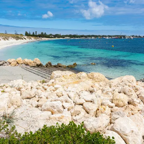
The Rottnest Island Management Plan 2023-28 identifies the need to redevelop the Army Groyne to alleviate increasing demand for commercial marine and barge services at the Main Jetty.
A WA State Government investment of $31.9 million will enable relocation of the existing barge and freight operations from the Main Jetty to South Thomson Bay, with the redevelopment of the Army Groyne into a Marine Logistics Hub.
Stage 1 of the project includes:
- Dredging.
- Breakwater/groyne upgrade and extension.
- Hardstand / laydown area and barge landing construction.
- Roadworks including bike path.
Stage 2 of the project includes:
- Land-backed wharf (alternative ferry berth).
- Small craft refuelling berth and fuel facility.
- Storage building construction.
The $31.9 million funding is to deliver stage 1 while stage 2 works is currently unfunded.
Key benefits
Environmental approval process
Following the public consultation in March and April 2024, RIA has submitted the proposal to the relevant environmental authorities for formal environmental assessment under the Environmental Protection Act 1986 and the Environmental Protection and Biodiversity Conservation Act 1999.
The project is being designed and will be constructed with appropriate avoidance, mitigation, and management measures to reduce environmental impacts where possible. RIA has developed a number of management plans, which will be in place to support the project:
- Construction Environmental Management Plan
- Dredging and Spoil Disposal Management Plan
- Operational Environmental Management Plan
These plans have been completed and form part of the overall Environmental Referral Document that has been submitted to relevant authorities.
Environmental supporting document
RIA is undertaking environmental approvals with the WA Environmental Protection Authority (EPA) to support the development of the Marine Logistics Hub.
The Environmental Supporting Document has been prepared in accordance with EPA procedures and describes the proposal, the likely environmental impacts and the proposed management measures.
The Environmental Supporting Document is available as a series of PDF downloads. Please note that some documents may take longer to load due to file size.
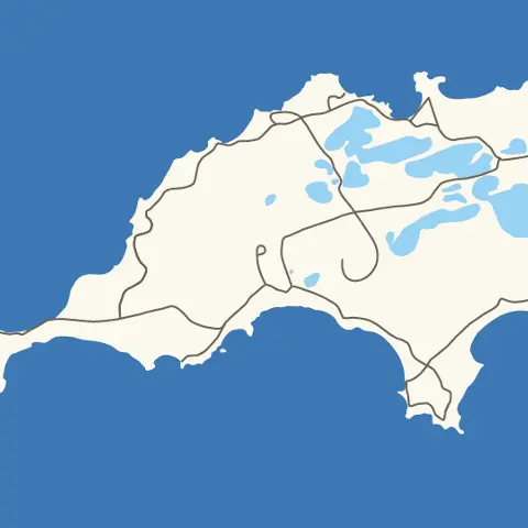
Location

Frequently asked questions
Relocating the barge operations provides a safer and more appealing entry to Rottnest Island for visitors arriving on the ferry. The barge and its associated operations now require more space to effectively meet the growing demands of visitors and island businesses.
Technical studies have been undertaken to determine the extent of temporary and permanent impacts to the marine environment.
Permanent impacts to the marine environment:
- Removal of 2.39 hectares of seagrass.
- Removal of marine fauna habitats due to dredging and construction.
- Increased light emissions.
- Increased risk of introduced marine species.
- Increased risk of pollution incidents.
- Increased vessel collision risk.
- Minor changes to coastal processes, i.e. sediment and wrack movement.
Temporary impacts to the marine environment during construction:
- Increased turbidity.
- Increased sedimentation / suspended solids within the water.
- Decrease in light availability.
- Elevated underwater increase in noise (proposed construction methodology means impacts are unlikely to be significant).
Up to 0.25 hectares of native vegetation will be cleared. The vegetation is categorised as forest and woodlands of the Swan Coastal Plain, and is listed as critically endangered at a state level. Studies within the area have indicated that no conservation significant species are within the project footprint.
Permanent impacts to the terrestrial environment:
- Permanent removal of 0.25 hectares of native vegetation (Melaleuca Woodland) and terrestrial fauna habitat.
- Relocation of the boat ramp.
Download a map of the Terrestrial Vegetation Impact (1.9MB PDF)
Wadjemup is of deep cultural and spiritual significance to all Aboriginal people. The area within the project footprint has been surveyed and no Aboriginal cultural heritage sites or material has been found within this area. Consultation with Traditional Owners is being undertaken.
There is potential that some moorings will need to be relocated within close proximity. RIA will notify any impacted license holders.
Yes, an area of approximate 1.13 hectares will be dredged around the existing Army Groyne.
The Army Groyne is not listed under statutory heritage listing, but is deemed historically significant and classified as a "heritage building". Parts of the existing groyne will form the foundations of the proposed development.
RIA is looking into options for the safe management of recreational fishers and beachgoers in and around the proposed barge operations area. It is RIA's intention to maintain public access to appropriate areas. The outcome of the public access assessment will be incorporated into the final design.
RIA will be submitting the project to the relevant environmental authorities for formal environmental assessment under the Environmental Protection Act 1986 and Environmental Protection and Biodiversity Conservations Act 1999. The consultation forms part of the environmental approval process.
Contact and further information
Funding


.tmb-fallback.webp?Culture=en&sfvrsn=c9e756ff_1)


.tmb-fallback.webp?Culture=en&sfvrsn=81e0d42c_1)
.tmb-fallback.webp?Culture=en&sfvrsn=bc40030_1)

.tmb-fallback.webp?Culture=en&sfvrsn=e5f359db_1)